Saturday, November 24, 2018

Portland Metro Area: Eastbank Esplanade Waterfront Park Loop

I know my review of the 4T trail was negative, but fortunately I have a much better walk for your outdoor family experience. You can take a nice scenic loop along the Willamette River much more easily.
First of all, there is much better signage.

That is not specifically for the trail, but rather for nearby attractions and streets.

There actually can be some ambiguity for the route. I entered Tom McCall Waterfront Park from the Yamhill MAX stop, crossed on the Steel Bridge, went along the Eastbank Esplanade to the Hawthorne Bridge, and then went back to my starting point.

You can cross on the Burnside Bridge instead to shorten the route, although it is less convenient. I believe you can also keep going on for a while past the Steel Bridge.

You can definitely go past the Hawthorne Bridge to OMSI, and I believe cross on the Tillicum Crossing. I still believe it is easier to have all of those things be decisions and choices rather than getting lost.

I think this route is more scenic than the 4T in general, but also, I was interested to notice that for all of these empty moorings, the Portland Maritime Museum does actually use these lines to stay securely in their port. These are real working moorings!

Speaking of the Maritime Museum, this route also has many options for combining with other activities.
Not only are the Maritime Museum and Saturday Market right there, but you are also close to OMSI, as previously mentioned, and the departure point for the Portland Spirit. There are the various sections of the park, and the Oregon Convention Center which is also near the Oregon Rail Heritage Center.


There are rentals for bikes, scooters, and surrey style bikes, all of which passed me at one point or the other, but without any crowding or collisions.

There is also fishing, though it may be better to stick with catch and release. The sign seemed pretty discouraging.

It is also less steep than the 4T trail, which has its advantages.

I mean, I did find it more relaxing, but mainly I just found it prettier.


There is less landscaping along the East side, but they put in more art and that is interesting too.


There are also more places to obtain fresh water.

Here is the most important piece of advice I have for you, though it could easily not matter. As you reach the Hawthorne Bridge on the East side, you will see signs for the bus stops going East and going West. If you are catching a bus, pay attention, because you will not want to try crossing that busy street!

If you are just going over the bridge, following that signage can get you on the side of the bridge that matches the traffic flow, but the walkways are so wide it isn't a big deal.

Then you can take a stairway back into the park, or follow the ramp (with a nice walkway) into downtown Portland. It is safe for pedestrians (something not always considered with the 4T).

That is why I found this walking trail superior. However, if you want something more challenging, try the Wildwood Trail in Washington Park. (Although it is pretty easy to get lost there.)

Thank you Vera Katz and Tom McCall!

Saturday, November 17, 2018

Portland Metro Area: 4T Trail

What a nightmare.

Perhaps my first clue should have been that it doesn't have its own web page, or a page specific to it through Tri-Met or Portland Parks or something like that. There is writing about it, but a lot of it is reviews like this, which I probably should have read more carefully.

The thing is, everyone knows about it. You see signs for it everywhere. It even shows up on lists of things that if you haven't done, you are not a real Portlander. I have to assume at this point that whoever did that list has not done the 4T, and I bet they don't worry about their Portland-cred.

I get the logic behind it. Tram to streetcar to train is a fun sequence, and walking makes it a trail. To ride the tram free, you need to get on at the top (it costs $4 to ride up). There are probably other paths that you can take up to the tram, but not that connect with MAX. In that way, going from the Washington Park stop to OHSU via Marquam makes sense. There are just some problems with that route.

Shockingly, the issue is not the difficulty of the trail, though it is pretty steep. I mean, I am sure other people do the trail faster with less panting, but we still made it.

(I do feel bad about assuming that when the children of a friend referred to it as the Bataan Death March that it was childish exaggeration. I mean, nobody died. Still, I see what they meant now.)

No, there were two main problems. The one was bad enough, and then the other caught us off guard to be the cherry on top.

The first issue is the lack of good markers. We started noticing this before we had even gotten out of the zoo parking lot. I think part of it is that they try to make the trail markers useful from whatever direction you approach in, and you can do the trail either way, though I believe Zoo to OHSU is more common.

Also, sometimes you can have multiple options. For example, it looked like we could either cross 26 on the first overpass or turn right and go alongside 26 on the zoo side some more. There was another overpass, and you could probably cross there as well, with just a little more walking, but it's nice to have clarity, and we ended up missing that more and more.

We decided to take the first overpass based on reading other people writing about the trail. Once on the other side, nothing looked right. We first went the wrong way, then looked up the trail again, and headed toward Portland where there was in fact a trail offshoot that could only be seen after you walk counter-intuitively down along a busy freeway.

(Julie was the one who kept looking things up on her phone, and it was good she was there.)

Once we found an actual trail head we thought, Great! Now the only challenge is the physical exertion of a steep hike! (The online reviews did say that the opening leg was pretty steep.)

We were so naive.


It was pretty steep, starting with a path shored up by railway tie steps that promptly tripped me, but we had planned on a steep hike along with an exploration of public transit that would make us true Portlanders. I had not even ruled out that I might trip at some point, because I am me. We did not plan on getting so horribly lost.

If we thought the lack of signage was bad around Washington Park, it was much worse once we emerged at the top of that trail. We had a few more false starts, referring to the phone - and other hikers with similar questions.

I suspect the issue here is that we were now in neighborhoods - more expensive neighborhoods, at the top of the hill - and clear signage and sidewalks (there were some not great road shoulders) would do even more to bring in the riff raff.

We came to an area where there were three possible directions. The far left was road and had a hospital sign. It also went down. Although we were heading to a hospital, and all three hospitals up there are pretty close to each other, it did not seem right to go down a road. Off to the right were two branching trails.

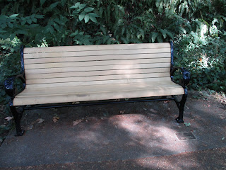
We chose wrong, but at least there was a bench.

We emerged in Council Crest Park, with no clear path to the tram from there. I had sort of expected an end to the ambiguity at that point. We might have found an alternative by going further up, but we asked for directions instead. What broke us was that the person we asked said we needed to go back down the path we had just come up.

No doubt our next choice was bad, so maybe we deserved what happened. Julie ordered an Uber to get us to OHSU. After all, we had still hiked a lot, and we could do the rest. No we couldn't. It was Memorial Day and the tram was closed. There's the cherry.

That's right. The fun family activity to do on a day off involves a component that does not run on the holidays when people are looking for fun family activities.

A lot of the online writing about the 4T trail will tell you how to follow it. The need to explain makes sense, even if the instructions then seem even more confusing. However, I can easily simplify all of that now that I have done it myself.

Don't do the 4T trail.

Easy.

UPDATE:  I recently went to OHSU by car, and the driver took a route that seemed familiar. I realized we were at the point where we had gotten lost. The driver in fact did take the lower road, marked hospital, confirming also what the person we spoke to in the park said.

Having gone along that road now, I can confidently say that the trail is even worse than I thought. Even if we had chosen right, we would have been walking along a winding road with poor shoulders and lots more up and down, that we still would have been constantly thinking that we were wrong, and we could easily have been hit by a car.

DO NOT DO THE 4T TRAIL!

Saturday, November 10, 2018

Forest Grove, Oregon - World's Tallest Barber Pole

If you are browsing information on roadside attractions, you may come across the world's tallest barber pole being in located in Lincoln Park in Forest Grove, Oregon. That may seem interesting, but random.
 Then you might see the sign referring to "Ballad Town USA", and think, "Forest Grove is Ballad Town?" Pretty much. There is an annual contest for barbershop quartets of the Pacific Northwest called Ballad Town, and it takes place in Forest Grove. Who knew?

That alone might not get it such an incredibly tall pole, but that comes from an Oregonian's desire to smash the previous world record holder in Texas. Texas may be bigger in a lot of ways, but its trees aren't! We probably also have a better wine country.

I suppose this means that if you go to pole yourself, a perfectly reasonable way to commemorate the occasion would be breaking out your best rendition of "Sweet Adeline". I just took a selfie.


 The other thing that seems pertinent for potential visitors is that a 70-foot barber pole doesn't stand out as much as you would think. This is somewhat exacerbated by an apparent reluctance for places in Forest Grove to have specific published addresses. The pole is outside Hanson Stadium, and both the pole and the Stadium I have found listed as "Main Street", which is only true inasmuch as the connected streets appear to be nameless.

So, going North on Main Street, turn right into Rogers Park. If you hit 266th you have gone too far. Then the first left should take you right by the pole.

Good luck. We stumbled around a bit, but we did find it. I have the selfie to prove it.

https://www.roadsideamerica.com/tip/1049

https://www.oregonlive.com/forest-grove/index.ssf/2013/03/worlds_tallest_barber_pole_was.html